Welcome to your mission – stopping the bulldozers in their tracks.
Firstly, make sure you sign up to become an investigator with ACF investigates, our citizen science project to help uncover deforestation using satellite imagery on your phone.
Now you’ve got your mission brief: Bulldozers = bad. Stop bulldozers. But you’re still feeling a little unsteady on your feet. Don’t worry! You’re in the right place. On this page, you’ll find all the information you need to expose those bulldozers
Grab a cuppa. Let’s dive in.
Your task
On your screen you'll see two images overlayed on top of each other – from 2025 and 2026. You’ll see the after image by default, and you can use the slider or tap to go back in time.
Usually, you're going to see changes that occurred this year, but occasionally you will see an area that was already bare soil last summer, and then some kind of groundcover has regrown since then.
It doesn't matter whether you're on before or after, or where your slider is when you select - the data is going to come through to us exactly the same way.
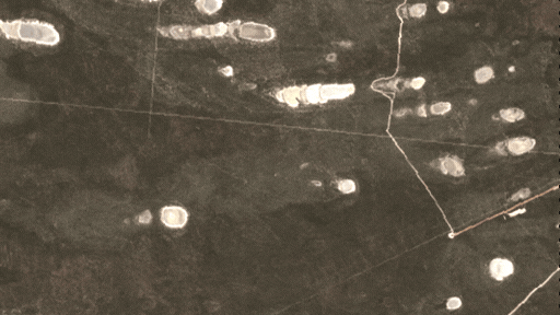
Flag image error
This button is for when the image is broken, or so cloudy that it’s impossible to classify as showing deforestation or not.
Once five different people have flagged an image as broken, it’ll be taken out of the pool, so no one else wastes their time on it.
An example of a image error in the platform
How long should you spend on each task?
Each image is shown to multiple people, so you don’t have to be 100% sure – 90% sure is excellent.
There are about eight thousand image pairs, so every contribution helps - and it's much better for us if you check ten images for a minute each than one image for ten minutes.
Once you've got the hang of investigating, you want to average about one minute on each image. After one minute - skip or submit.
If you're not sure you can see deforestation after looking at an image for one minute, chances are either there is none, or it's not going to land on our list of priority cases. Skip or submit!
The right answer might be that there is no clearing! We’ve used a first-class computer algorithm to detect possible clearing events, but there’s still lots of false positives – that's why we need you.
You can always get guidance from the help menu or by joining us on Discord
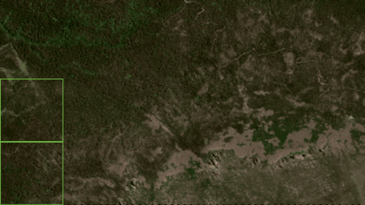
Next, we're going to take a quick look at five different types of land clearing to look out for and the top four mistakes to avoid.
Top five types of land clearing
The point of this breakdown is to help train your eye to see deforestation in its many forms - you don't actually need to tell us which type it is.
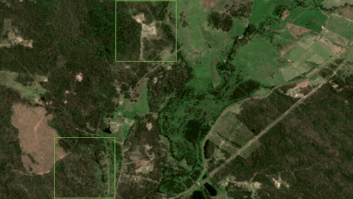
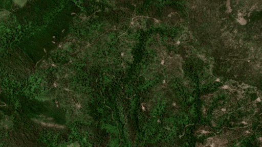
Broadscale bulldozing. Also called clearfelling, or clearcutting, in this clearing you'll see a clearly defined patch of land where all of the trees are gone. This is the easiest type to spot.
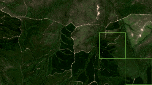
Linear clearing. You're going to see this along fencelines, property lines and road lines, expanding the edges of earlier deforestation, or fragmenting.
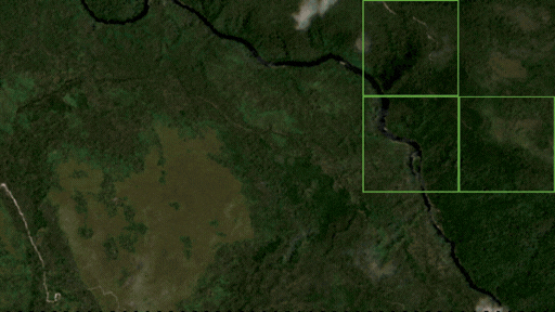
Thinning. This is when not all of the trees disappear from an area, but a significant number of trees have been removed, changing the quality of the habitat.
Strip clearing or strip cutting is the removal of narrow, alternating strips of trees. Look out for new stripey patterns appearing.
Patch clearing or patch cutting is the selective clearing of smaller patches - if it adds up to more than 10 hectares, it could still significantly impact important habitat, and we still want to know.
Top five mistakes to avoid
It’s easy to get tripped up by things that look very similar to clearing. These are the top six things that get mistaken for clearing so you know what to look for.

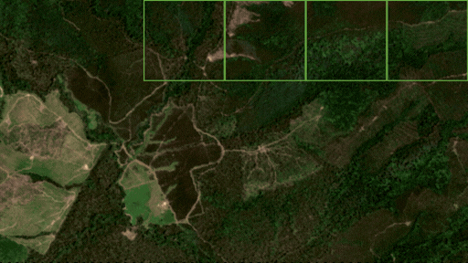
Plantation logging
In this image you can see both types of clearing – remnant forest and plantation forest. Please ignore the plantation forest, as this is unlikely to be vital habitat for threatened species.
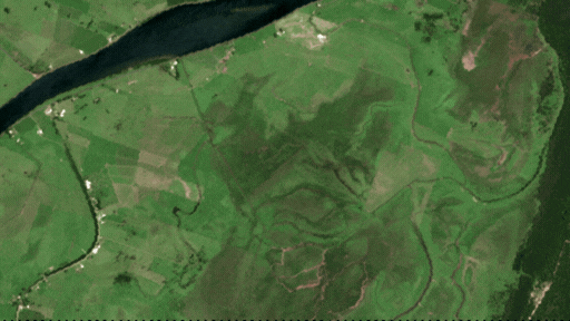
Groundcover changes and crops
For the purposes of this investigation we are only interested in deforestation, that is the disappearance of bushland habitat that has at least some tree canopy and is at least 15 years old. This isn’t because forest is the only important habitat – it’s just the easiest type of habitat for us to monitor from space.
Look for trees missing and ignore changes to groundcover, e.g. crops, pasture, invasive grass, as well as wetlands, native grasslands and low scrubland. These usually appear as brighter, smoother, more uniform green.
One trick to tell whether you’re looking at changes to trees or groundcover is to start off by looking at the image and deciding where you think bushland is vs low scrub, grass or maybe even mudflats or desert. To identify bushland/natural trees, look for texture, randomness (as opposed to straight lines for an orchard), height compared to the surrounding landscape, and colour.
In this photo, the trees/bushland is highlighted – everything else is groundcover.
Please ignore groundcover loss, and if you can only see groundcover changes, please select zero squares and hit that submit button.
Clouds
We've done our best to mask out clouds, but some are unavoidable. If you can still see the image well enough to tell if there is clearing, submit or skip as normal. If not, please flag the image for removal using the ‘something’s wrong’ button.
Bushfires
Our algorithm is trained to ignore bushfires, but some may have snuck in. Distinguishing bushfires from clearing can be tricky because fire scars look so different depending on where in Australia you are looking (i.e. whether it’s a lush rainforest in Queensland or sandy-soiled scrubland in WA), how recently the fire happened, and how the fire was controlled. Here we’ve included a few different examples of what fire can look like:
Generally, manmade clearing for the sake of clearing will have more defined edges, whereas fire scars will be organic forms, but there are exceptions – sometimes a wildfire is fought at a road or fenceline, which will give the fire scar at least one straight edge along a property.
If you're not sure if you're looking at a bushfire or clearing, ask us on Discord. Please ignore changes to canopy caused by fire, and if you can only see changes caused by fire, please select zero squares and hit that submit button.
Seasonal changes and weather events
The best rule of thumb is that if you're not sure if it’s canopy loss or seasonal drying AND you think it's either all squares or no squares, then it's only seasonal change.
Seasonal changes usually impact the whole landscape. The images you’re looking at are 1800 hectares or 18 square kilometers, about the size of two Sydney airports. Although clearing on that scale does happen, it is very rare.
To minimise seasonal changes, we have selected images from the same time of year, a year apart, but one summer might be much dryer than the one before, especially in arid environments.
All these impacts usually affect whole satellite images, and/or they will obviously affect groundcover colour and even canopy colour, but the trees will still be there.
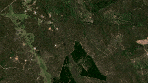
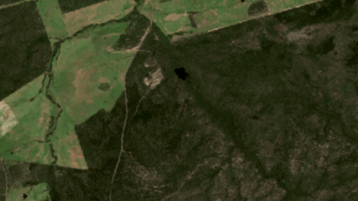
The most confusing seasonal change is probably when bodies of water like riverbeds, ponds and dams dry up. They can appear as dark patches in the “before” image, and then as bare soil in the “after” image. We’ve even seen algal blooms on shallow lakes trick our algorithm – don't let them trick you!
Please ignore landscape-wide drying, and if you can only see seasonal changes, please select zero squares and hit that submit button.
What about overgrazing?
Overgrazing can in theory be illegal, but it’s much more difficult to prove than the sort of deforestation we are looking for.
Does overgrazing put damaging pressure on threatened species and our biodiversity? Absolutely. Should you mark it as clearing for this investigation? No; unfortunately, it’s outside the scope of this project.
Please ignore grazing and overgrazing, and if you can only see groundcover changes, please select zero squares and hit that submit button.
You’re ready to go!
Make sure you bookmark this page in your browser so you can refer back to it later if you want. We’ll also have a handy help menu available as your work through the tasks.
If you haven't yet, sign up to become an investigator with ACF investigates and help be our eyes in the sky!
Thank you for helping us to stop the bulldozers and protect forests and precious threatened wildlife.